Area Input Files (.IN/.IN3)
Overview
Area Input Files are one of the basic files when working with ENVI-met. They specify the geometry of model environment such as buildings, plants or soils in detail.
Information stored in the Area Input Files include:
- position and height of buildings
- position of plants
- distribution of surface materials and soil types
- position of sources
- position of receptors
- database links
- geographic position of the location on earth
From Version 3.1 on, the number of nesting grids, the soil information for the nesting grids, the model rotation and the position on earth are now stored in the Area Input File, not in the Configuration File! ENVI-met will not accept .IN files in an old format. If you want to re-use some older file, you must open it in the Editor first and save it once to convert it into the post V4.0 format!
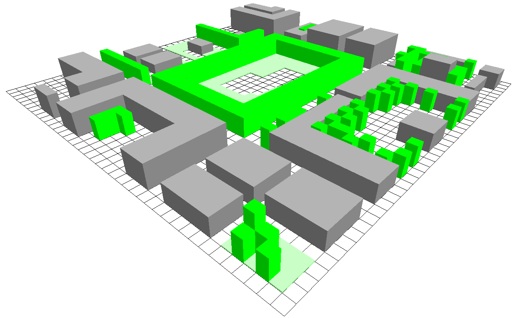
The model domain is organised as a rectangular area which extends in x-, y- and z- direction.
In Area Input Files, you don't “see” the z-direction as you work in the horizontal view only (since Version 3.1), but it is an important part of the model.
The following figure shows the same example shown in 3D above in the horizontal view as it appears in the ENVI-met Editor:

The Area Input Files are ASCII files using a matrix format with strict format rules that must be followed to decode the data correctly.
Normally it is not necessary for you to deal with the internal details of the file format. It is recommended that you use the ENVI-met editor to create and maintain your Area Input Files!
